Surveying
Surveying
Bathymetric surveys provide topographic data below the water surface
Volume and location of sediment are a critical factor of dredging cost
Sediment types can vary in particle sizes, chemical characteristics, and depths all within one project
Surveying
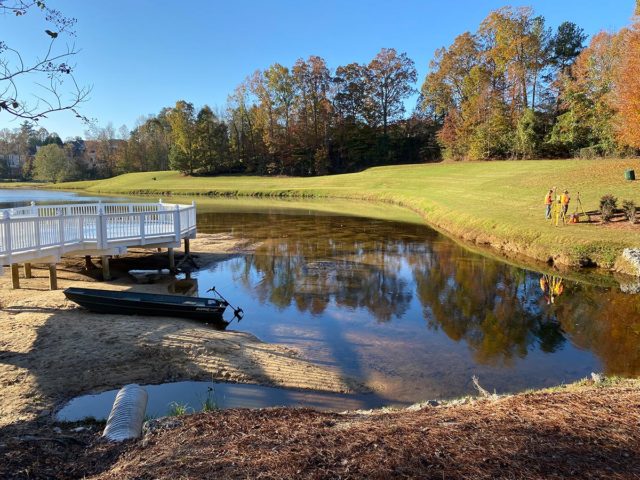
Lake Mapping and Sediment Surveying
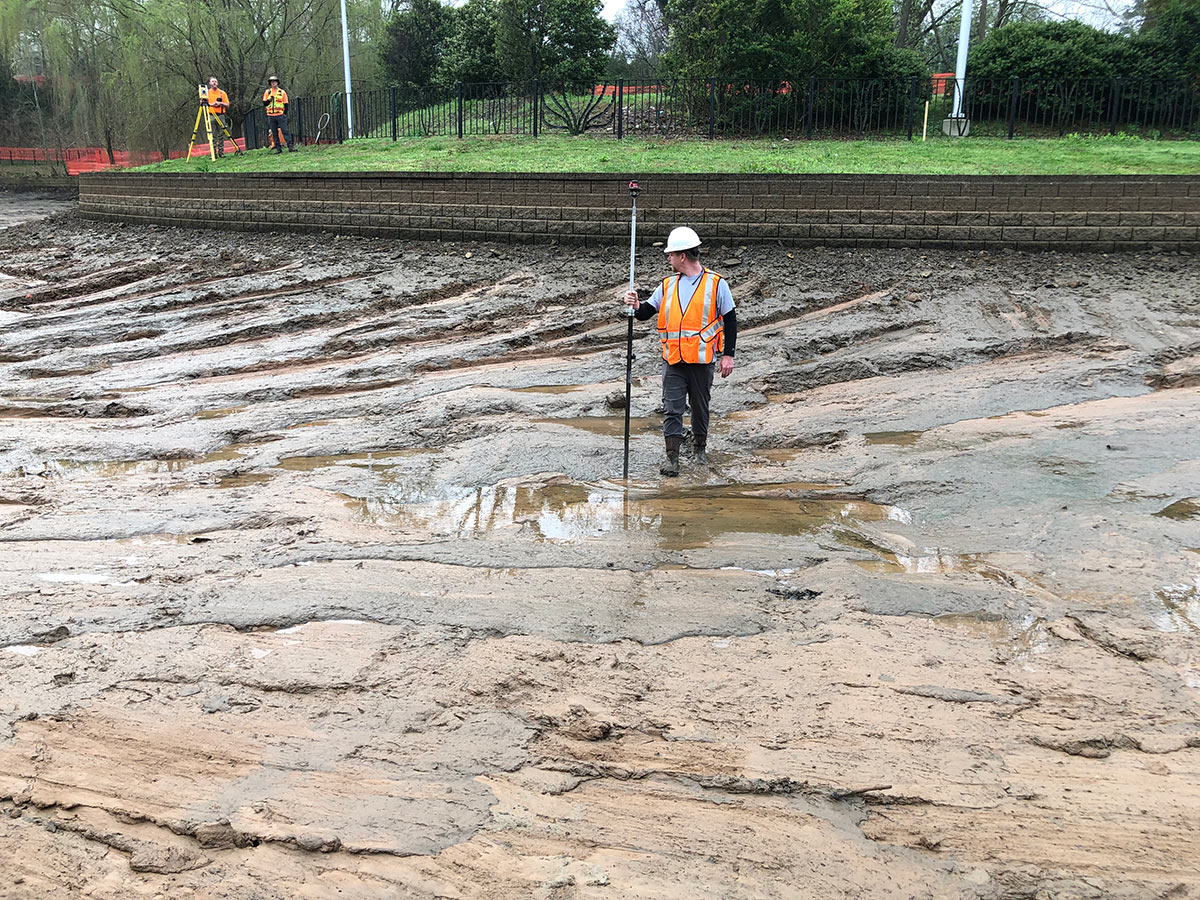
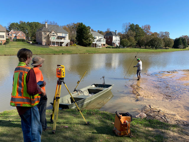
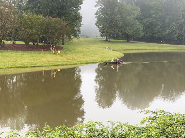
Data before you dredge is a vital step. An unsuccessful dredging project may quickly end because of poor planning and not knowing what to expect below the water surface. Bathymetric surveying usually refers to mapping the top of the surface below the water surface. Water depths are an important aspect when planning where to dredge, if a dredge will have enough water to float, or how far to lower the water level. Hydrographic surveying is a broader term that includes mapping both the water depth and sediment characteristics. Sedimentation surveys will include the location and depth of sediment relative to the water surface and most of the time the hard-pan (original lake bottom) that is typically denser composition material (clay, rock, liner, etc.). Surveys may include core sampling to determine the density, composition, particle size distribution, and other sediment characteristics by depth. Depending on the project you may only need a certain set of data to base your dredging project on. Surveying can also help identify issues common with dredging such as coarse debris, uneven surfaces, stumps/logs, and other anomalies. River Sand can collect samples using Vibracore, various hand-held sediment samplers, sludge judge, or even an Eckman dredge/sampler. We have our own soil laboratory and work with several independent laboratories for analysis.
Do I need to map or survey my lake, pond, or lagoon?
If you are considering removing the sand, silt, muck, or sludge from your waterbody, knowing how much will be a critical factor. Dredging cost are often reflected in cubic yards or dry tons/solids. River Sand offers mapping for planning or pre- and post- dredge mapping. Our equipment involves the latest differential GPS (DGPS) with real tim kinematic (RTK) receivers often paired with echo or sonar equipment when applicable. We have a wide range of boats and sampling tools necessary to gather information and samples. Surveying is best done after you have an initial consult to determine if dredging makes sense as a solution. There are some initial steps to confirm sedimentation issues prior to paying for a survey to be completed. Regardless, surveying in some form most often precedes a successful dredging project.
How do I calculate how much sediment is in my lake or pond?
River Sand can provide a professional survey with sub-centimeter accurate data points. But you may be wondering how I can just get an idea of how much is beneath the surface. One way to estimate the muck below the water is to use the simple formula for determining any volume – length x width x height. Generally finding an area of an impacted area can be done using measurements from aerial images with a scale or measurement tool prior to even getting in the water. An alternative is using a measuring tape (300’ are common most hardware stores) or even better a range finder (common in hunting and golf applications). Once you determine the area you would like to survey, the next step is to determine the depth of sediment. There are methods for calculating volume on a grid system but that gets complicated. Usually, an average depth is best even if you need to break your single areas into multiple areas with differing depths. To measure the depth, use a probe 1” or less in diameter (wooden handle, rebar, pvc pipe, etc.) and work it into the sediment until you feel a consolidated (hard) bottom. You can measure the sediment depth by subtracting the difference in the water depth to the top of the sediment. Remember to convert feet to yards or vice versa before multiplying to get your estimate.
This method can give you an idea of the volume you need to remove and the increase in water depth you may be achieve with dredging. However, this is not a method for basing a project or a contractual agreement upon. We have seen a lot of projects not get what they paid for because they lack the information confirming that the agreed upon amount has been removed after dredging is completed. Surveying or confirmation of some type should always be an important part of your dredging project.
Can you tell where sediment came from?
Sediment tracking is a very difficult process. There are times that sediment includes markers or characteristics that identify the source. However, in most watersheds sedimentation occurs from the entire landscape and mixes together before reaching the next stream, lake, pond, or reservoir. Sediment layers can provide context and clues to seasonal patterns (i.e. Fall – leaves dropping) or large events with different characteristics. Sediment can be collected with cores and characterized by color (Munsell color chart) for oxidation/reduction and texture (sand/silt/clay content). This may offer some insight to the timing and type of sedimentation that has occurred. Measuring the change in volume of sediment over time can lead to sourcing of sediment. Contractors/developers and lake/pond owners are using our pre-construction surveys as a means of quantifying actual impacts to the waterbody. Often upstream sources have a baseline prior to construction so that post construction surveys measure impact if any for avoiding unnecessary mitigation. Lake owners use surveying as a measure of protection from upstream impacts, especially within large storm events, unauthorized land disturbance, or BMP failures.
Lake, Pond, and Reservoir Mapping:
River Sand, inc. can provide mapping, surveying, core sample collection and analysis. Results can be provided with technical specifications or in a manner for homeowners to view and understand suitable for presentations. We include much of our mapping and surveying within the dredging project cost. The quality of our survey results are backed with QA protocols and reviewed by an engineer. Many surveys may look good on paper but the methods and equipment do not provide suitable restraints for accurate results. River Sand understands the benefits of a great survey, and uses them to make certain you get what you pay for with your dredging project.
This method can give you an idea of the volume you need to remove and the increase in water depth you may be achieve with dredging. However, this is not a method for basing a project or a contractual agreement upon. We have seen a lot of projects not get what they paid for because they lack the information confirming that the agreed upon amount has been removed after dredging is completed. Surveying or confirmation of some type should always be an important part of your dredging project.
Frequently Asked Questions
Do you have questions about River Sand? We have answers!
A bathymetric survey is the measurement of the water depth in a lake, pond, or other water body. It maps depths along with other underwater features. Sediment surveys use this data in addition to the depth of sediment to the original bottom, hardpan. A sediment survey can determine the depth of sediment throughout the lake and also the quantity of sediment within the lake.
A sediment survey or bathymetric survey can help determine the amount of sediment within a lake. Surveys involved finding the top of sediment and the bottom with a probe to determine the sediment depth in a particular location. That location can be used to determine an area to calculate a volume. Sediment is typically measured in cubic yards. Sludge is usually measured in dry tons.
The best way to determine the amount of silt in a pond or lake is to perform a bathymetric or sediment survey. You can set up a grid with a long tape measure and calculate the volume of sediment along with the depth for a general idea. A GPS or rangefinder with a probe can also be used to estimate the volume. The most accurate method is to have a survey completed by a professional. Otherwise, you may just be guessing until you find out when you dig it out.
Related Articles
See what we’ve been saying about
River Sand

“If you have a project that requires any sand at all then River Sand should be your resource. They not only met our specs on varying levels of texture, but calculated our needs to do so. They not only cared about the sale, but the cause for which the need existed. I highly recommend anything that River Sand produces!”
— Brett B. | Facilities Director at Woodlands Christian Camp & Conference Center
Related Products
Estimate Your Dredging Project
Other projects and In-Field Mix are calculated separately.